

With a new update, the search giant Google has introduced an overlay of COVID case trends as a new safety tool on its platform. This tool will be helpful in getting critical info about the number of COVID-19 cases in your area so that you can make more informed decisions before they travel to a city, state and even countries as getting around is more complicated these days
Over the past few months features such as popular times and live busyness, COVID-19 alerts in transit, and COVID checkpoints in driving navigation have already being introduced by Google in Maps. But now it has come up with a new safety to track COVID-19 cases in an area. The special COVID layer to Google Maps will start rolling out globally to Android as well as iOS devices this week onwards.
According to the blog post, a tool can be found in your Google Maps and toggling through this will show up the seven-day average number of confirmed cases in each area per 100,000 people for the area of the map you’re looking at, and a label that indicates whether the cases are trending up or down.
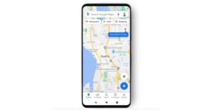
The layer button can be found on the top right-hand corner of your screen. Hitting the button will let you see a trend of new COVID cases info. The colour coding will help you easily distinguish the density of new cases in an area. Trending case data is visible at the country level for all 220 countries and territories that Google Maps supports, along with state or province, county, and city-level data where available.

The COVID overlay gets its data from multiple authoritative sources, including Johns Hopkins, the New York Times, and Wikipedia. While these sources get the data from public health organizations like the World Health Organization, government health ministries, along with state and local health agencies and hospitals. Many of these sources already power COVID case information in Search, and we’re now expanding this data to Google Maps.
“While getting around is more complicated these days, our hope is that these Google Maps features will help you get where you need to be as safely and efficiently as possible. The COVID layer starts rolling out worldwide on Android and iOS this week,” wrote Sujoy Banerjee, a Google Maps project manager, in a blog post.
For the latest gadget and tech news, and gadget reviews, follow us on Twitter, Facebook and Instagram. For newest tech & gadget videos subscribe to our YouTube Channel. You can also stay up to date using the Gadget Bridge Android App.
