

We don’t need to tell you that Google Maps comes in extremely handy while travelling or when you’re on vacation. Apart from guiding you to your destination and providing time-saving routes, Google Maps is equipped with several other features that are useful in navigating a place you don’t know. Have you ever found yourself looking for gas stations in a neighbourhood you’re not familiar with? Google Maps can help you with your situation. In this article, we show you how to find the nearest gas stations or petrol pumps using Google Maps.
Read Also: Top 10 smartphones with the best fast chargers
In This Article
Find the nearest gas stations or petrol pumps on Google Maps
Step 1: Launch the Google Maps app on your smartphone.
Step 2: Scroll the categories under the search bar and tap on ‘More’.

Step 3: Scroll down to the ‘Sevices’ section and select ‘Gas’. Depending on your location, it may be called Gas or Petrol.

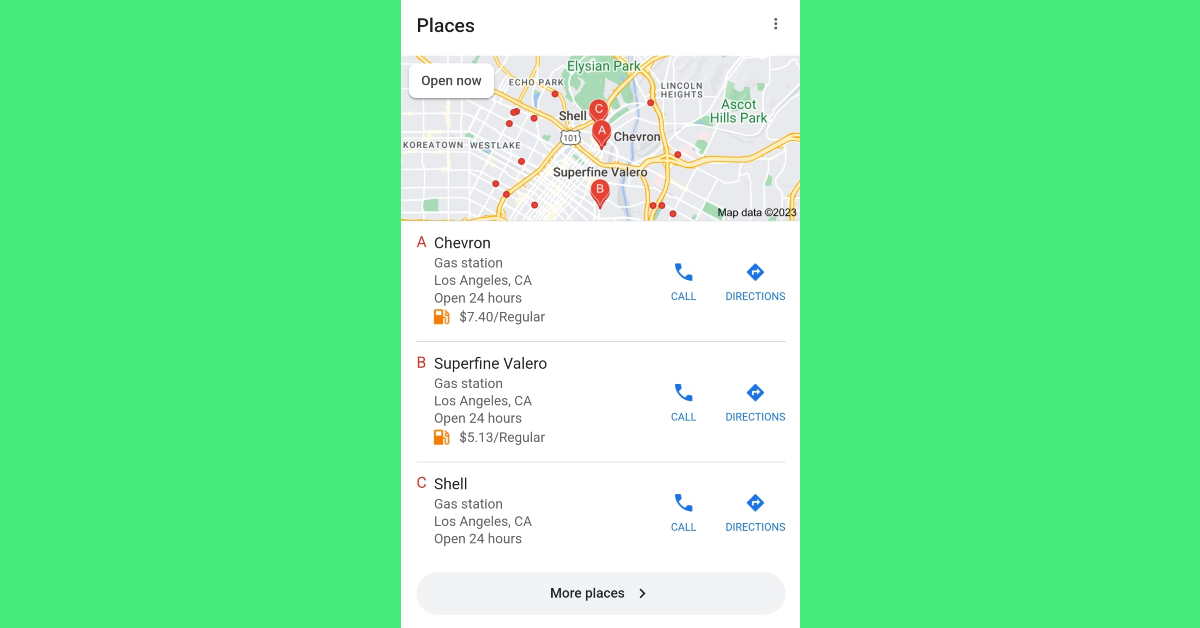
Step 4: All the petrol pumps in your area will be marked on the map with a red icon. Tap on an icon to view the details of the gas station. You can also browse through the entire list by swiping right on the names of the gas stations.

Perform a simple Google Search
If you don’t want to search for the nearest gas stations on Google Maps, you can simply perform a Google search instead. Launch the web browser on your smartphone and search for ‘Gas stations near me’ on Google. Make sure your location services are turned on. You will see a list of results with entries from gas stations nearest to you. Tap on Directions to open the result in Google Maps.
Frequently Asked Questions (FAQs)
How do I find the nearest gas stations or petrol pumps in Google Maps?
When you open Google Maps on your phone, you will see a list of services on the top menu. If the ‘gas stations’ category isn’t on the list, hit ‘More’ and select it. All the gas stations nearest to your location will pop up on the map.
How do I search for the nearest gas stations on Google?
Search for ‘gas stations near me’ on Google to find the filling services that are nearest to your location. Make sure you turn on the location tile from the quick settings menu before searching. Hit the ‘Directions’ icon in the search results to open the location in Google Maps.
How do I rate a gas station on Google Maps?
Open the page for the gas station on Google Maps after searching for it within the app. Switch to the reviews tab to give it a star rating.
Read Also: Infinix Hot 30i smartphone and Y1 Plus Neo laptop to launch in India soon
Conclusion
This is how you can find the nearest gas stations or petrol pumps using Google Maps. You can use the same method to locate gas stations near you using Google Maps on Android Auto, Apple CarPlay, or on your home PC. You can also click on a gas station to see the user views and images of the location before pulling into it.
