

Google Maps is an excellent tool for navigation and route planning. If you want to find the distance between two towns, all you need to do is enter their names in the map and the app will do the rest for you. But what if you want to find the distance of a hiking trail that isn’t listed on the map? Or a random plot of land by the side of a road? You will be surprised to know that Google Maps can help you with that too. In this article, we show you how to measure the distance between two points on Google Maps.
Read Also: Best Air Purifiers under Rs 10,000 you can buy right now (2023)
In This Article
Measure the distance between two points on Google Maps
Step 1: Launch the Google Maps app on your smartphone.
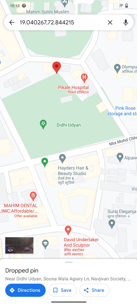
Step 2: Long press on the starting point to drop the red pin.
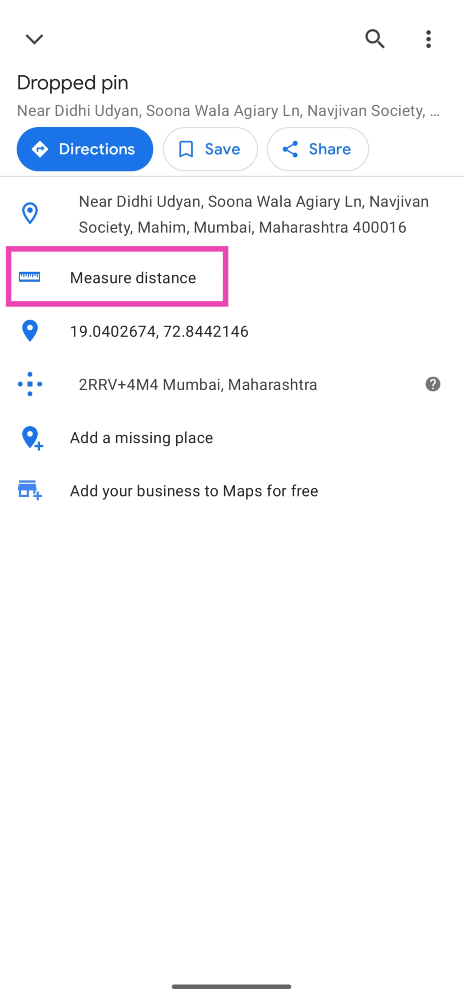
Step 3: Swipe up and select Measure Distance.
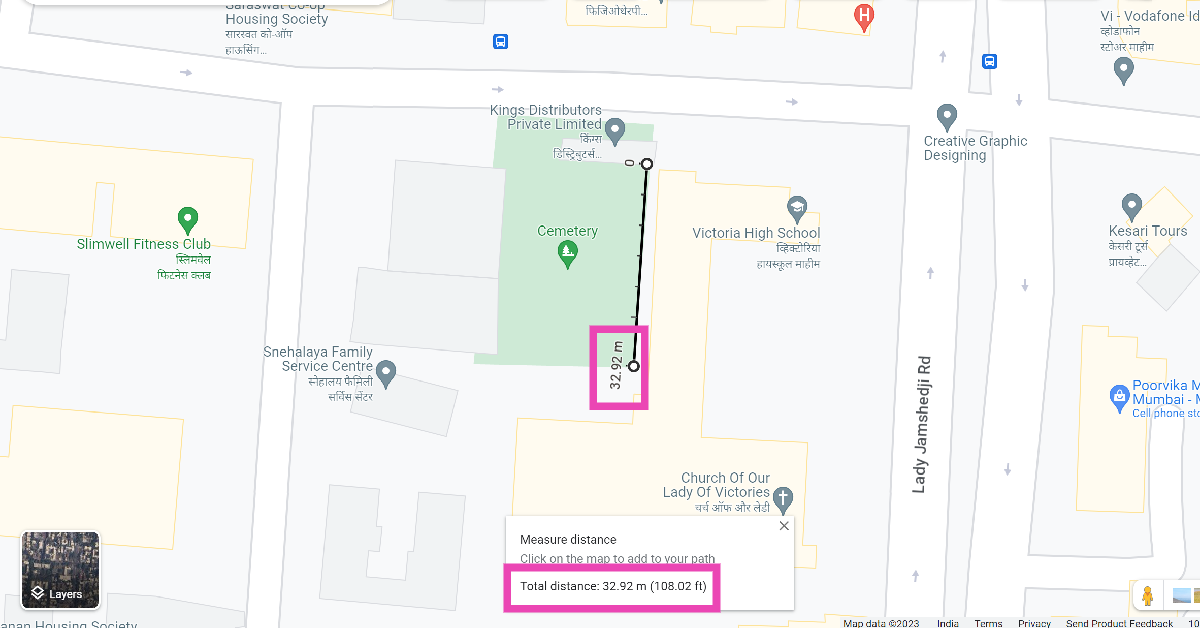
Step 4: Now, drag the map to your destination.
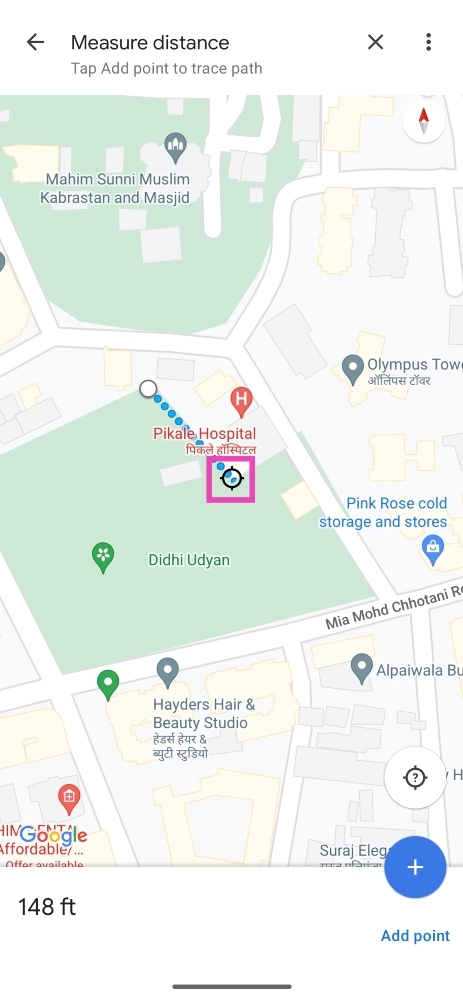
Step 5: Google Maps will display the distance between the two points.
Step 6: To find the area of a particular location, simply tap on Add Point after dropping the pin and drag the map along every corner.
Measure distance on Google Maps for PC
Step 1: On your PC, go to https://www.google.com/maps.
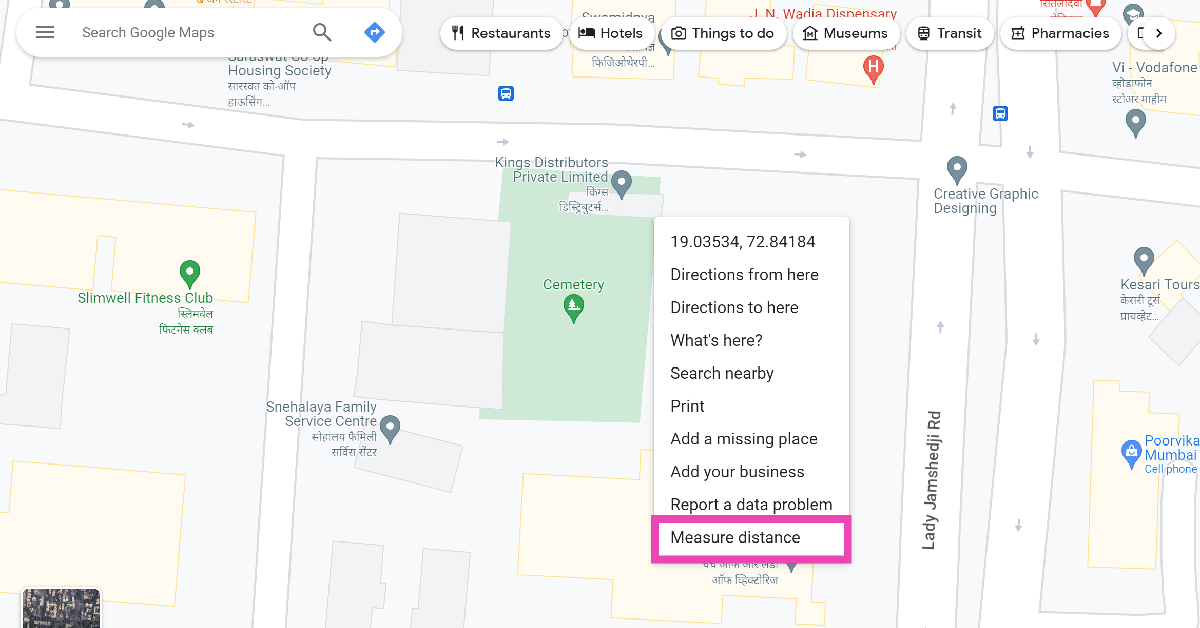
Step 2: Right-click on the starting point and select Measure Distance.
Step 3: Click on the destination point.
Step 4: You will be able to view the distance between the two points at the bottom of the screen.
Step 5: To calculate the area of a plot, keep adding points along its boundary until it is enclosed by a polygon.
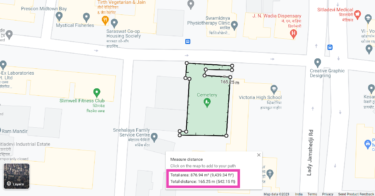
Step 6: You will be able to view the area of the plot at the bottom of the screen.
Frequently Asked Questions (FAQs)
How do I measure the distance between two random points on the Google Maps app?
Tap and hold to drop the pin on Point A and drag the map until you reach Point B. The app will display the distance between the two points.
How do I measure the area of a plot of land on Google Maps?
Go to the Google Maps website, right-click on the starting point and select Measure Distance. Keep adding points along the corners of the selected plot of land to measure its area.
How do I save a random location on Google Maps?
To save a random, unnamed location on Google Maps, simply press and hold it on the map and hit Save.
Read Also: Samsung Galaxy A05s new variant launched in India
Conclusion
This is how you can measure the distance between two points on Google Maps. You can use this feature to find the distance of any unnamed plot of land or hiking trail anywhere on the map. The readings from Google Maps are generally very accurate and reliable. They are very close to the industry standard and can be used for casual tasks.
